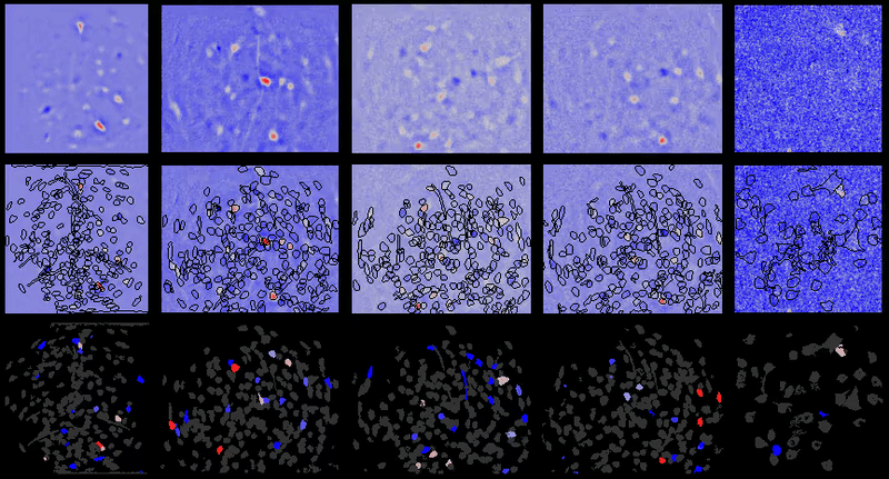
With the increased use of calcium (and voltage) imaging for a plethora of
research purposes, the need for tools that can accurately, quickly, and efficiently
process this data is needed. As a graduate student in Mark Schnitzer's lab, I built and furthered new
tools (e.g. CELLMax and CLEAN) and software packages (see CIAtah, https://github.com/bahanonu/ciatah) to
improve analysis of calcium imaging data. While there are existing reviews
covering calcium imaging analysis, I decided to expand upon the table in my
dissertation to include more recent and additional older algorithms, tools, and
analysis pipelines. Those interested in a brief overview of calcium imaging, see
the return of the brain initiative notes.
The table below is primarily focused on tools for calcium imaging, but some of
them also include tools for voltage imaging, data handling for biology,
and more. The goal will be to expand this to include additional imaging
analysis tools going forward and I might make it more dynamic akin to my
Nobel Prize Browser.
B Srinivasa Reddy and Biswanath N Chatterji. An fft-based technique
for translation, rotation, and scale-invariant image registration. IEEE
transactions on image processing, 5(8):1266–1271, 1996.
Philippe Thevenaz, Urs E Ruttimann, and Michael Unser. A pyramid
approach to subpixel registration based on intensity. Image Processing,
IEEE Transactions on, 7(1):27–41, 1998.
Hassan Foroosh, Josiane B Zerubia, and Marc Berthod. Extension of
phase correlation to subpixel registration. IEEE transactions on image
processing, 11(3):188–200, 2002.
J N Kerr, D Greenberg, and F Helmchen. Imaging input and output
of neocortical networks in vivo. Proc Natl Acad Sci U S A, 102(39):
14063–14068, 2005. ISSN 0027-8424 (Print) 0027-8424. doi: 10.1073/pnas.
0506029102.
K V Kuchibhotla, S Wegmann, K J
Kopeikina, J Hawkes, N Rudinskiy, M L Andermann, T L Spires-Jones,
B J Bacskai, and B T Hyman. Neurofibrillary tangle-bearing neurons are
functionally integrated in cortical circuits in vivo. Proc Natl Acad Sci U S
A, 111(1):510–514, 2014. ISSN 0027-8424. doi: 10.1073/pnas.1318807111.
Simon P. Peron, Jeremy Freeman, Vijay Iyer, Caiying Guo, and Karel
Svoboda. A Cellular Resolution
Map of Barrel Cortex Activity during Tactile Behavior. Neuron, 86(3):
783–799, 2015. ISSN 10974199. doi: 10.1016/j.neuron.2015.03.027. URL
http://dx.doi.org/10.1016/j.neuron.2015.03.027.
Anne E Carpenter, Thouis R Jones, Michael R Lamprecht, Colin
Clarke, In Han Kang, Ola Friman, David A Guertin, Joo Han Chang,
Robert A Lindquist, Jason Moffat, et al. Cellprofiler: image analysis
software for identifying and quantifying cell phenotypes. Genome biology,
7(10):1–11, 2006.
Claire McQuin, Allen Goodman, Vasiliy Chernyshev, Lee Kamentsky,
Beth A Cimini, Kyle W Karhohs, Minh Doan, Liya Ding, Susanne M
Rafelski, Derek Thirstrup, et al. Cellprofiler 3.0: Next-generation image
processing for biology. PLoS biology, 16(7):e2005970, 2018.
Michael R Lamprecht, David M Sabatini, and Anne E Carpenter.
Cellprofiler™: free, versatile software for automated biological image
analysis. Biotechniques, 42(1):71–75, 2007.
Eran A Mukamel, Axel Nimmerjahn, and Mark J Schnitzer. Automated
analysis of cellular signals from large-scale calcium imaging data. Neuron,
63(6):747–760, 2009.
Brian B Avants, Nick Tustison, Gang Song, et al. Advanced
normalization tools (ants). Insight j, 2(365):1–35, 2009.
Stefan Klein, Marius Staring, Keelin Murphy, Max A Viergever, and
Josien PW Pluim. Elastix: a toolbox for intensity-based medical image
registration. IEEE transactions on medical imaging, 29(1):196–205, 2009.
David S Greenberg and Jason ND Kerr. Automated correction of fast
motion artifacts for two-photon imaging of awake animals. Journal of
neuroscience methods, 176(1):1–15, 2009.
A Miri, K Daie,
R D Burdine, E Aksay, and D W Tank. Regression-based identification
of behavior-encoding neurons during large-scale optical imaging of neural
activity at cellular resolution. J Neurophysiol, 105(2):964–980, 2011. ISSN
1522-1598 (Electronic) 0022-3077 (Linking). doi: 10.1152/jn.00702.2010.
URL http://www.ncbi.nlm.nih.gov/pubmed/21084686.
Angela Bauch, Izabela Adamczyk, Piotr Buczek, Franz-Josef Elmer,
Kaloyan Enimanev, Pawel Glyzewski, Manuel Kohler, Tomasz Pylak,
Andreas Quandt, Chandrasekhar Ramakrishnan, et al. openbis: a flexible
framework for managing and analyzing complex data in biology research.
BMC bioinformatics, 12(1):1–19, 2011.
M Francis, X Qian, C Charbel, J Ledoux, J C Parker, and M S Taylor.
Automated region of interest analysis of dynamic Ca(2)+ signals in image
sequences. Am J Physiol Cell Physiol, 303(3):C236–43, 2012. ISSN
0363-6143. doi: 10.1152/ajpcell.00016.2012.
Chris Allan, Jean-Marie Burel, Josh Moore, Colin Blackburn, Melissa
Linkert, Scott Loynton, Donald MacDonald, William J Moore, Carlos
Neves, Andrew Patterson, et al. Omero: flexible, model-driven data
management for experimental biology. Nature methods, 9(3):245–253, 2012.
Ferran Diego, Susanne Reichinnek, Martin Both, and Fred A Hamprecht.
Automated identification of neuronal activity from calcium imaging by
sparse dictionary learning. In Biomedical Imaging (ISBI), 2013 IEEE 10th
International Symposium on, pages 1058–1061. IEEE, 2013.
Jakub Tomek, Ondrej Novak, and Josef Syka. Two-photon processor and
seneca: a freely available software package to process data from two-photon
calcium imaging at speeds down to several milliseconds per frame. Journal
of neurophysiology, 110(1):243–256, 2013.
Eftychios A Pnevmatikakis, Yuanjun Gao, Daniel Soudry, David Pfau,
Clay Lacefield, Kira Poskanzer, Randy Bruno, Rafael Yuste, and Liam
Paninski. A structured matrix factorization framework for large scale
calcium imaging data analysis. arXiv preprint arXiv:1409.2903, 2014.
Ryuichi Maruyama, Kazuma Maeda, Hajime Moroda, Ichiro Kato,
Masashi Inoue, Hiroyoshi Miyakawa, and Toru Aonishi. Detecting cells
using non-negative matrix factorization on calcium imaging data. Neural
Netw, 55:11–19, mar 2014. ISSN 0893-6080. doi: 10.1016/j.neunet.2014.
03.007. URL http://www.ncbi.nlm.nih.gov/pubmed/24705544.
Patrick Kaifosh, Jeffrey D Zaremba, Nathan B Danielson, and Attila
Losonczy. SIMA: Python software for analysis of dynamic fluorescence
imaging data. Frontiers in neuroinformatics, 8:80, 2014.
Dimitri Yatsenko, Jacob Reimer, Alexander S Ecker, Edgar Y Walker,
Fabian Sinz, Philipp Berens, Andreas Hoenselaar, R James Cotton,
Athanassios S Siapas, and Andreas S Tolias. Datajoint: managing big
scientific data using matlab or python. BioRxiv, page 031658, 2015.
Jeffery L Teeters, Keith Godfrey, Rob Young, Chinh Dang, Claudia
Friedsam, Barry Wark, Hiroki Asari, Simon Peron, Nuo Li, and Adrien
Peyrache. Neurodata without borders: creating a common data format for
neurophysiology. Neuron, 88(4):629–634, 2015.
Marius Pachitariu, Carsen Stringer, Sylvia Schröder, Mario Dipoppa,
L Federico Rossi, Matteo Carandini, and Kenneth D Harris. Suite2p:
beyond 10,000 neurons with standard two-photon microscopy. Biorxiv,
page 061507, 2016.
Eftychios A Pnevmatikakis, Daniel Soudry, Yuanjun Gao, Timothy A
Machado, Josh Merel, David Pfau, Thomas Reardon, Yu Mu, Clay
Lacefield, Weijian Yang, et al. Simultaneous denoising, deconvolution, and
demixing of calcium imaging data. Neuron, 89(2):285–299, 2016.
P Zhou, SL Resendez, GD Stuber, RE Kass, and L Paninski. Efficient
and accurate extraction of in vivo calcium signals from microendoscope
video data. arXiv preprint arXiv:1605.07266, 2016.
Pengcheng Zhou, Shanna L Resendez, Jose Rodriguez-Romaguera,
Jessica C Jimenez, Shay Q Neufeld, Andrea Giovannucci, Johannes
Friedrich, Eftychios A Pnevmatikakis, Garret D Stuber, Rene Hen,
et al. Efficient and accurate extraction of in vivo calcium signals from
microendoscopic video data. ELife, 7:e28728, 2018.
Noah Apthorpe, Alexander Riordan, Robert Aguilar, Jan Homann,
Yi Gu, David Tank, and H Sebastian Seung. Automatic neuron detection
in calcium imaging data using convolutional networks. In Advances in
Neural Information Processing Systems, pages 3270–3278, 2016.
Alexander Dubbs, James Guevara, and Rafael Yuste. moco: Fast motion
correction for calcium imaging. Frontiers in neuroinformatics, 10:6, 2016.
Raphaël Marée, Loïc Rollus, Benjamin Stévens, Renaud Hoyoux,
Gilles Louppe, Rémy Vandaele, Jean-Michel Begon, Philipp Kainz, Pierre
Geurts, and Louis Wehenkel. Collaborative analysis of multi-gigapixel
imaging data using cytomine. Bioinformatics, 32(9):1395–1401, 2016.
Ali I Mohammed, Howard J Gritton, Hua-an Tseng, Mark E Bucklin,
Zhaojie Yao, and Xue Han. An integrative approach for analyzing hundreds
of neurons in task performing mice using wide-field calcium imaging.
Scientific reports, 6(1):20986, 2016.
B. Ahanonu, L. J. Kitch, T. H. Kim, M. C. Larkin, E. O. Hamel,
J. Lecoq, D. E. Aldarondo, and M. J. Schnitzer. Maximum likelihood and
machine learning based methods for automated cell sorting of large-scale
neural calcium imaging data. Society for Neuroscience, 2018. URL
https://abstractsonline.com/pp8/#!/4649/presentation/41917.
B. Ahanonu, L. J. Kitch, T. H. Kim, M. C. Larkin,
E. O. Hamel, J. Lecoq, and M. J. Schnitzer. Maximum
likelihood based cell sorting of large-scale neural calcium
imaging data. Society for Neuroscience, 2017. URL
http://www.abstractsonline.com/pp8/index.html#!/4376/presentation/18520.
Biafra Owowonta Ahanonu. Neural Ensemble Dynamics in Behaving
Animals: Computational Approaches and Applications in Amygdala and
Striatum. Stanford University, 2018.
Jinghao Lu, Chunyuan Li, and Fan Wang. Seeds cleansing cnmf for
spatiotemporal neural signals extraction of miniscope imaging data. arXiv
preprint arXiv:1704.00793, 2017.
Johannes Friedrich, Pengcheng Zhou, and Liam Paninski. Fast online
deconvolution of calcium imaging data. PLoS computational biology, 13
(3):e1005423, 2017.
Stephanie Reynolds, Therese Abrahamsson, Renaud Schuck, P Jesper
Sjöström, Simon R Schultz, and Pier Luigi Dragotti. Able: An
activity-based level set segmentation algorithm for two-photon calcium
imaging data. eNeuro, pages ENEURO–0012, 2017.
Ashley Petersen, Noah Simon, and Daniela Witten. SCALPEL:
Extracting Neurons from Calcium Imaging Data. ArXiv e-prints, art.
arXiv:1703.06946, March 2017.
Quico Spaen, Dorit S Hochbaum, and Roberto Asín-Achá. Hnccorr:
A novel combinatorial approach for cell identification in calcium-imaging
movies. arXiv preprint arXiv:1703.01999, 2017.
Andrea Giovannucci, Johannes Friedrich, Matt Kaufman, Anne
Churchland, Dmitri Chklovskii, Liam Paninski, and Eftychios A
Pnevmatikakis. Onacid: Online analysis of calcium imaging data in real
time. In Advances in Neural Information Processing Systems, pages
2381–2391, 2017.
Hakan Inan, Murat A Erdogdu, and Mark Schnitzer. Robust estimation
of neural signals in calcium imaging. In Advances in Neural Information
Processing Systems, pages 2901–2910, 2017.
JG Orlandi,
S Fernández-García, A Comella-Bolla, M Masana, G García-Díaz
Barriga, M Yaghoubi, A Kipp, JM Canals, MA Colicos, J Davidsen,
et al. Netcal: An interactive platform for large-scale, network and
population dynamics analysis of calcium imaging recordings, zenodo
(2017).
Eftychios A Pnevmatikakis and Andrea Giovannucci. Normcorre: An
online algorithm for piecewise rigid motion correction of calcium imaging
data. Journal of neuroscience methods, 291:83–94, 2017.
Liron Sheintuch, Alon Rubin, Noa Brande-Eilat, Nitzan Geva, Noa Sadeh,
Or Pinchasof, and Yaniv Ziv. Tracking the same neurons across multiple
days in ca2+ imaging data. Cell reports, 21(4):1102–1115, 2017.
Jiangheng Guan, Jingcheng Li, Shanshan Liang, Ruijie Li, Xingyi Li,
Xiaozhe Shi, Ciyu Huang, Jianxiong Zhang, Junxia Pan, Hongbo Jia,
et al. Neuroseg: automated cell detection and segmentation for in vivo
two-photon ca 2+ imaging data. Brain Structure and Function, 223(1):
519–533, 2018.
Takashi Takekawa, Hirotaka Asai, Noriaki Ohkawa, Masanori Nomoto,
Reiko Okubo-Suzuki, Khaled Ghandour, Masaaki Sato, Yasunori Hayashi,
Kaoru Inokuchi, and Tomoki Fukai. Automatic sorting system for large
calcium imaging data. bioRxiv, page 215145, 2017.
Sebastián A Romano, Verónica Pérez-Schuster, Adrien Jouary,
Jonathan Boulanger-Weill, Alessia Candeo, Thomas Pietri, and Germán
Sumbre. An integrated calcium imaging processing toolbox for the analysis
of neuronal population dynamics. PLoS computational biology, 13(6):
e1005526, 2017.
Martin Rueckl, Stephen C Lenzi, Laura Moreno-Velasquez, Daniel
Parthier, Dietmar Schmitz, Sten Ruediger, and Friedrich W Johenning.
Samuroi, a python-based software tool for visualization and analysis of
dynamic time series imaging at multiple spatial scales. Frontiers in
neuroinformatics, 11:44, 2017.
Alexander Fillbrunn, Christian Dietz, Julianus Pfeuffer, René Rahn,
Gregory A Landrum, and Michael R Berthold. Knime for reproducible
cross-domain analysis of life science data. Journal of biotechnology, 261:
149–156, 2017.
Aleksander Klibisz, Derek Rose, Matthew Eicholtz, Jay Blundon, and
Stanislav Zakharenko. Fast, simple calcium imaging segmentation with
fully convolutional networks. In International Workshop on Deep Learning
in Medical Image Analysis, pages 285–293. Springer, 2017.
Sander W Keemink, Scott C Lowe, Janelle MP Pakan, Evelyn Dylda,
Mark CW Van Rossum, and Nathalie L Rochefort. Fissa: A neuropil
decontamination toolbox for calcium imaging signals. Scientific reports, 8
(1):1–12, 2018.
Gal Mishne, Ronald R Coifman, Maria Lavzin, and Jackie Schiller.
Automated cellular structure extraction in biological images with
applications to calcium imaging data. bioRxiv, page 313981, 2018.
E Kelly Buchanan, Ian Kinsella, Ding Zhou, Rong Zhu, Pengcheng Zhou,
Felipe Gerhard, John Ferrante, Ying Ma, Sharon Kim, Mohammed Shaik,
et al. Penalized matrix decomposition for denoising, compression, and
improved demixing of functional imaging data. bioRxiv, page 334706, 2018.
Jinghao Lu, Chunyuan Li, Jonnathan Singh-Alvarado, Zhe Charles
Zhou, Flavio Fröhlich, Richard Mooney, and Fan Wang. MIN1PIPE: A
Miniscope 1-Photon-Based Calcium Imaging Signal Extraction Pipeline.
Cell Reports, 23(12):3673–3684, 2018. ISSN 2211-1247.
Andrea Giovannucci, Johannes Friedrich, Pat Gunn, Jeremie Kalfon,
Sue Ann Koay, Jiannis Taxidis, Farzaneh Najafi, Jeffrey L Gauthier,
Pengcheng Zhou, and David W Tank. CaImAn: An open source tool for
scalable Calcium Imaging data Analysis. bioRxiv, page 339564, 2018.
Jeffrey L Gauthier, Sue Ann Koay, Edward H Nieh, David W Tank,
Jonathan W Pillow, and Adam S Charles. Detecting and correcting false
transients in calcium imaging. bioRxiv, page 473470, 2018.
Simon P Shen, Hua-an Tseng, Kyle R Hansen, Ruofan Wu, Howard J
Gritton, Jennie Si, and Xue Han. Automatic cell segmentation by adaptive
thresholding (acsat) for large-scale calcium imaging datasets. eneuro, 5(5),
2018.
Akinori Mitani and Takaki Komiyama. Real-time processing of
two-photon calcium imaging data including lateral motion artifact
correction. Frontiers in neuroinformatics, 12:98, 2018.
Gregory Corder, Biafra Ahanonu, Benjamin F Grewe, Dong Wang,
Mark J Schnitzer, and Grégory Scherrer. An amygdalar neural ensemble
that encodes the unpleasantness of pain. Science, 363(6424):276–281, 2019.
Biafra Ahanonu and Gregory Corder. Recording pain-related brain
activity in behaving animals using calcium imaging calcium imaging and
miniature microscopes. In Contemporary Approaches to the Study of Pain:
From Molecules to Neural Networks, pages 217–276. Springer, 2022.
Adam S Charles, Alex Song, Jeffrey L Gauthier, Jonathan W Pillow,
and David W Tank. Neural anatomy and optical microscopy (naomi)
simulation for evaluating calcium imaging methods. bioRxiv, page 726174,
2019.
FDW Radstake, EAL Raaijmakers, R Luttge, Svitlana Zinger, and
Jean-Philippe Frimat. Calima: The semi-automated open-source calcium
imaging analyzer. Computer methods and programs in biomedicine, 179:
104991, 2019.
Somayyeh Soltanian-Zadeh, Kaan Sahingur, Sarah Blau, Yiyang Gong,
and Sina Farsiu. Fast and robust active neuron segmentation in two-photon
calcium imaging using spatiotemporal deep learning. Proceedings of the
National Academy of Sciences, 116(17):8554–8563, 2019.
Yizhi Wang, Nicole V DelRosso, Trisha V Vaidyanathan, Michelle K
Cahill, Michael E Reitman, Silvia Pittolo, Xuelong Mi, Guoqiang Yu,
and Kira E Poskanzer. Accurate quantification of astrocyte and
neurotransmitter fluorescence dynamics for single-cell and population-level
physiology. Nature Neuroscience, 22(11):1936–1944, 2019.
Andrea Giovannucci, Johannes Friedrich, Pat Gunn, Jeremie Kalfon,
Brandon L Brown, Sue Ann Koay, Jiannis Taxidis, Farzaneh Najafi,
Jeffrey L Gauthier, Pengcheng Zhou, et al. Caiman an open source tool
for scalable calcium imaging data analysis. Elife, 8:e38173, 2019.
Gal Mishne and Adam S Charles. Learning spatially-correlated
temporal dictionaries for calcium imaging. In ICASSP 2019-2019 IEEE
International Conference on Acoustics, Speech and Signal Processing
(ICASSP), pages 1065–1069. IEEE, 2019.
Noah Dolev, Lior Pinkus, and Michal Rivlin-Etzion. Segment2p:
Parameter-free automated segmentation of cellular fluorescent signals.
BioRxiv, page 832188, 2019.
Zhe Chen, Hugh T Blair, and Jason Cong. Lanmc: Lstm-assisted
non-rigid motion correction on fpga for calcium image stabilization.
In Proceedings of the 2019 ACM/SIGDA International Symposium on
Field-Programmable Gate Arrays, pages 104–109, 2019.
Ryohei Shibue and Fumiyasu Komaki. Deconvolution of calcium imaging
data using marked point processes. PLoS computational biology, 16(3):
e1007650, 2020.
Shreya Saxena, Ian Kinsella, Simon
Musall, Sharon H Kim, Jozsef Meszaros, David N Thibodeaux, Carla
Kim, John Cunningham, Elizabeth MC Hillman, Anne Churchland, et al.
Localized semi-nonnegative matrix factorization (locanmf) of widefield
calcium imaging data. PLOS Computational Biology, 16(4):e1007791,
2020.
Daniel A Cantu, Bo Wang, Michael W Gongwer, Cynthia X He,
Anubhuti Goel, Anand Suresh, Nazim Kourdougli, Erica D Arroyo,
William Zeiger, and Carlos Portera-Cailliau. Ezcalcium: Open source
toolbox for analysis of calcium imaging data. bioRxiv, 2020.
Johannes Friedrich, Andrea Giovannucci, and
Eftychios A Pnevmatikakis. Online analysis of microendoscopic 1-photon
calcium imaging data streams. bioRxiv, 2020.
Lina M Tran, Andrew J Mocle, Adam I Ramsaran, Alex D Jacob,
Paul W Frankland, and Sheena A Josselyn. Automated curation
of cnmf-e-extracted roi spatial footprints and calcium traces using
open-source automl tools. bioRxiv, 2020a.
Lina M Tran, Andrew J Mocle, Adam I Ramsaran, Alexander D
Jacob, Paul W Frankland, and Sheena A Josselyn. Automated curation
of cnmf-e-extracted roi spatial footprints and calcium traces using
open-source automl tools. Frontiers in Neural Circuits, 14:42, 2020b.
Jerome Lecoq, Michael Oliver, Joshua H Siegle, Natalia Orlova, and
Christof Koch. Removing independent noise in systems neuroscience data
using deepinterpolation. bioRxiv, 2020.
Ulysse Rubens, Romain Mormont, Lassi Paavolainen, Volker Bäcker,
Benjamin Pavie, Leandro A Scholz, Gino Michiels, Martin Maška,
Devrim Ünay, Graeme Ball, et al. Biaflows: A collaborative framework
to reproducibly deploy and benchmark bioimage analysis workflows.
Patterns, 1(3):100040, 2020.
Ryan M Cassidy, Alexis G Bavencoffe, Elia R Lopez, Sai S Cheruvu,
Edgar T Walters, Rosa A Uribe, Anne Marie Krachler, and Max A
Odem. Frequency-independent biological signal identification (fibsi): A
free program that simplifies intensive analysis of non-stationary time series
data. bioRxiv, 2020.
Sascha RA Alles, Max A Odem, Van B Lu, Ryan M Cassidy, and
Peter A Smith. Chronic bdnf simultaneously inhibits and unmasks
superficial dorsal horn neuronal activity. Scientific reports, 11(1):1–14,
2021.
Elke Kirschbaum, Alberto Bailoni, and Fred A Hamprecht. Disco: deep
learning, instance segmentation, and correlations for cell segmentation in
calcium imaging. In Medical Image Computing and Computer Assisted
Intervention–MICCAI 2020: 23rd International Conference, Lima, Peru,
October 4–8, 2020, Proceedings, Part V 23, pages 151–162. Springer, 2020.
Julien Denis, Robin F Dard, Eleonora Quiroli, Rosa Cossart, and
Michel A Picardo. Deepcinac: a deep-learning-based python toolbox for
inferring calcium imaging neuronal activity based on movie visualization.
eneuro, 7(4), 2020.
Yaesop Lee, Jing Xie, Eungjoo Lee, Srijesh Sudarsanan, Da-Ting Lin,
Rong Chen, and Shuvra S Bhattacharyya. Real-time neuron detection and
neural signal extraction platform for miniature calcium imaging. Frontiers
in Computational Neuroscience, 14:43, 2020.
Chaozhen Tan, Yue Guan, Zhao Feng, Hong Ni, Zoutao Zhang, Zhiguang
Wang, Xiangning Li, Jing Yuan, Hui Gong, Qingming Luo, et al.
Deepbrainseg: Automated brain region segmentation for micro-optical
images with a convolutional neural network. Frontiers in neuroscience, 14:
179, 2020.
Victoria A Griffiths, Antoine M Valera, Joanna YN Lau, Hana
Roš, Thomas J Younts, Bóris Marin, Chiara Baragli, Diccon Coyle,
Geoffrey J Evans, George Konstantinou, et al. Real-time 3d movement
correction for two-photon imaging in behaving animals. Nature methods,
17(7):741–748, 2020.
Carsen Stringer, Tim Wang, Michalis Michaelos, and Marius Pachitariu.
Cellpose: a generalist algorithm for cellular segmentation. Nature Methods,
18(1):100–106, 2021.
Alexander Song, Jeff L Gauthier, Jonathan W Pillow, David W Tank,
and Adam S Charles. Neural anatomy and optical microscopy (naomi)
simulation for evaluating calcium imaging methods. Journal of
Neuroscience Methods, 358:109173, 2021.
Johannes
Friedrich, Andrea Giovannucci, and Eftychios A Pnevmatikakis. Online
analysis of microendoscopic 1-photon calcium imaging data streams. PLoS
computational biology, 17(1):e1008565, 2021.
Hakan Inan, Claudia Schmuckermair, Tugce Tasci, Biafra Ahanonu,
Oscar Hernandez, Jérôme Lecoq, Fatih Dinç, Mark J Wagner, Murat
Erdogdu, and Mark J Schnitzer. Fast and statistically robust cell
extraction from large-scale neural calcium imaging datasets. bioRxiv, 2021.
Zhe Dong, William Mau, Yu Susie Feng, Zachary T Pennington,
Lingxuan Chen, Yosif Zaki, Kanaka Rajan, Tristan Shuman, Daniel
Aharoni, and Denise J Cai. Minian: An open-source miniscope analysis
pipeline. bioRxiv, 2021.
Kushal Kolar, Daniel Dondorp, Jordi Cornelis Zwiggelaar, Jørgen
Høyer, and Marios Chatzigeorgiou. Mesmerize: a dynamically adaptable
user-friendly analysis platform for 2d & 3d calcium imaging data. bioRxiv,
page 840488, 2021.
Jérôme Lecoq, Michael Oliver, Joshua H Siegle, Natalia Orlova, Peter
Ledochowitsch, and Christof Koch. Removing independent noise in
systems neuroscience data using deepinterpolation. Nature Methods, pages
1–8, 2021.
Seungjae Han, Eun-Seo Cho, Inkyu Park, Kijung Shin, and Young-Gyu
Yoon. Efficient neural network approximation of robust pca for automated
analysis of calcium imaging data. In International Conference on Medical
Image Computing and Computer-Assisted Intervention, pages 595–604.
Springer, 2021.
Madhavi Tippani, Elizabeth A Pattie, Brittany A Davis, Claudia V
Nguyen, Yanhong Wang, Srinidhi Rao Sripathy, Brady J Maher, Keri
Martinowich, Andrew E Jaffe, and Stephanie Cerceo Page. Capture:
Calcium peak toolbox for analysis of in vitro calcium imaging data.
bioRxiv, 2021.
Peter Rupprecht, Stefano Carta, Adrian Hoffmann, Mayumi Echizen,
Antonin Blot, Alex C Kwan, Yang Dan, Sonja B Hofer, Kazuo Kitamura,
Fritjof Helmchen, et al. A database and deep learning toolbox for
noise-optimized, generalized spike inference from calcium imaging. Nature
Neuroscience, 24(9):1324–1337, 2021.
Changjia Cai, Johannes Friedrich, Amrita Singh, M Hossein Eybposh,
Eftychios A Pnevmatikakis, Kaspar Podgorski, and Andrea Giovannucci.
Volpy: automated and scalable analysis pipelines for voltage imaging
datasets. PLoS computational biology, 17(4):e1008806, 2021.
Xinyang Li, Guoxun Zhang, Jiamin Wu, Yuanlong Zhang, Zhifeng Zhao,
Xing Lin, Hui Qiao, Hao Xie, Haoqian Wang, Lu Fang, et al. Reinforcing
neuron extraction and spike inference in calcium imaging using deep
self-supervised denoising. Nature Methods, pages 1–6, 2021.
Leander
de Kraker, Koen Seignette, Premnath Thamizharasu, Bastijn JG van den
Boom, Ildefonso Ferreira Pica, Ingo Willuhn, Christiaan N Levelt, and
Chris van der Togt. Specseg: cross spectral power-based segmentation of
neurons and neurites in chronic calcium imaging datasets. bioRxiv, pages
2020–10, 2021.
Andrea Giovannucci, Changjia Cai, Cynthia Dong, Marton Rozsa, and
Eftychios Pnevmatikakis. Fiola: An accelerated pipeline for fluorescence
imaging online analysis. 2021.
Ryoma Hattori and Takaki Komiyama. Patchwarp:
Corrections of non-uniform image distortions in two-photon
calcium imaging data by patchwork affine transformations.
bioRxiv, 2021. doi: 10.1101/2021.11.10.468164. URL
https://www.biorxiv.org/content/early/2021/11/13/2021.11.10.468164.
Xiaohui Zhang, Eric C Landsness, Wei Chen, Hanyang Miao, Michelle
Tang, Lindsey M Brier, Joseph P Culver, Jin-Moo Lee, and Mark A
Anastasio. Automated sleep state classification of wide-field calcium
imaging data via multiplex visibility graphs and deep learning. Journal of
Neuroscience Methods, page 109421, 2021.
Philipp Flotho, Shinobu Nomura, Bernd Kuhn, and Daniel J Strauss.
Software for non-parametric image registration of 2-photon imaging data.
Journal of Biophotonics, 15(8):e202100330, 2022.
Yijun Bao, Somayyeh Soltanian-Zadeh, Sina Farsiu, and Yiyang Gong.
Segmentation of neurons from fluorescence calcium recordings beyond real
time. Nature machine intelligence, 3(7):590–600, 2021.
Masaki Taniguchi, Taro Tezuka, Pablo Vergara, Sakthivel Srinivasan,
Takuma Hosokawa, Yoan Chérasse, Toshie Naoi, Takeshi Sakurai,
and Masanori Sakaguchi. Open-source software for real-time calcium
imaging and synchronized neuron firing detection. In 2021 43rd Annual
International Conference of the IEEE Engineering in Medicine & Biology
Society (EMBC), pages 2997–3003. IEEE, 2021.
Brian R Mullen, Sydney C Weiser, Desiderio Ascencio, and James B
Ackman. Automated classification of signal sources in mesoscale calcium
imaging. bioRxiv, pages 2021–02, 2021.
Yina Wang, Henry Pinkard, Emaad Khwaja, Shuqin Zhou, Laura
Waller, and Bo Huang. Image denoising for fluorescence microscopy by
self-supervised transfer learning. bioRxiv, pages 2021–02, 2021.
Thibault Lagache, Alison Hanson, Jesús E Pérez-Ortega, Adrienne
Fairhall, and Rafael Yuste. Tracking calcium dynamics from individual
neurons in behaving animals. PLOS Computational Biology, 17(10):
e1009432, 2021.
Adam S Charles, Nathan Cermak, Rifqi O Affan, Benjamin B Scott,
Jackie Schiller, and Gal Mishne. Graft: graph filtered temporal dictionary
learning for functional neural imaging. IEEE Transactions on Image
Processing, 31:3509–3524, 2022.
Madhavi Tippani, Elizabeth A Pattie, Brittany A Davis, Claudia V
Nguyen, Yanhong Wang, Srinidhi Rao Sripathy, Brady J Maher, Keri
Martinowich, Andrew E Jaffe, and Stephanie Cerceo Page. Capture:
Calcium peaktoolbox for analysis of in vitro calcium imaging data. BMC
neuroscience, 23(1):71, 2022.
Leander de Kraker, Koen Seignette,
Premnath Thamizharasu, Bastijn JG van den Boom, Ildefonso Ferreira
Pica, Ingo Willuhn, Christiaan N Levelt, and Chris van der Togt. Specseg
is a versatile toolbox that segments neurons and neurites in chronic calcium
imaging datasets based on low-frequency cross-spectral power. Cell reports
methods, 2(10), 2022.
Luca Sità, Marco Brondi, Pedro Lagomarsino de Leon Roig, Sebastiano
Curreli, Mariangela Panniello, Dania Vecchia, and Tommaso Fellin. A
deep-learning approach for online cell identification and trace extraction in
functional two-photon calcium imaging. Nature Communications, 13(1):
1529, 2022.
Honghua Guan, Dawei Li, Hyeon-cheol Park, Ang Li, Yuanlei Yue,
Yung-Tian A Gau, Ming-Jun Li, Dwight E Bergles, Hui Lu, and Xingde
Li. Deep-learning two-photon fiberscopy for video-rate brain imaging in
freely-behaving mice. Nature communications, 13(1):1534, 2022.
Sharif Amit Kamran, Khondker Fariha Hossain, Hussein Moghnieh,
Sarah Riar, Allison Bartlett, Alireza Tavakkoli, Kenton M Sanders, and
Salah A Baker. New open-source software for subcellular segmentation
and analysis of spatiotemporal fluorescence signals using deep learning.
Iscience, 25(5), 2022.
Xinyang Li, Yixin Li, Yiliang Zhou, Jiamin Wu, Zhifeng Zhao, Jiaqi
Fan, Fei Deng, Zhaofa Wu, Guihua Xiao, Jing He, et al. Real-time
denoising enables high-sensitivity fluorescence time-lapse imaging beyond
the shot-noise limit. Nature Biotechnology, 41(2):282–292, 2023a.
Jeffrey L Gauthier, Sue Ann Koay, Edward H Nieh, David W Tank,
Jonathan W Pillow, and Adam S Charles. Detecting and correcting false
transients in calcium imaging. Nature Methods, 19(4):470–478, 2022.
Andres Flores-Valle and Johannes D Seelig. Axial motion estimation
and correction for simultaneous multi-plane two-photon calcium imaging.
Biomedical Optics Express, 13(4):2035–2049, 2022.
Weiyi Liu, Junxia Pan, Yuanxu Xu, Meng Wang, Hongbo Jia, Kuan
Zhang, Xiaowei Chen, Xingyi Li, and Xiang Liao. Fast and accurate motion
correction for two-photon ca2+ imaging in behaving mice. Frontiers in
Neuroinformatics, 16:851188, 2022.
Oliver Rübel, Andrew Tritt, Ryan Ly, Benjamin K Dichter, Satrajit
Ghosh, Lawrence Niu, Pamela Baker, Ivan Soltesz, Lydia Ng, Karel
Svoboda, et al. The neurodata without borders ecosystem for
neurophysiological data science. Elife, 11:e78362, 2022.
Zhe Chen, Garrett J Blair, Changliang Guo, Jim Zhou, Juan-Luis
Romero-Sosa, Alicia Izquierdo, Peyman Golshani, Jason Cong, Daniel
Aharoni, and Hugh T Blair. A hardware system for real-time decoding of
in vivo calcium imaging data. Elife, 12:e78344, 2023.
Yan Zhang, Márton Rózsa, Yajie Liang, Daniel Bushey, Ziqiang
Wei, Jihong Zheng, Daniel Reep, Gerard Joey Broussard, Arthur Tsang,
Getahun Tsegaye, et al. Fast and sensitive gcamp calcium indicators for
imaging neural populations. Nature, 615(7954):884–891, 2023a.
Zhehao Xu, Yukun Wu, Jiangheng Guan, Shanshan Liang, Junxia Pan,
Meng Wang, Qianshuo Hu, Hongbo Jia, Xiaowei Chen, and Xiang Liao.
Neuroseg-ii: A deep learning approach for generalized neuron segmentation
in two-photon ca2+ imaging. Frontiers in Cellular Neuroscience, 17:
1127847, 2023.
Pablo Vergara, Yuteng Wang, Sakthivel Srinivasan, Yoan Cherasse,
Toshie Naoi, Yuki Sugaya, Takeshi Sakurai, Masanobu Kano, and Masanori
Sakaguchi. The caliali tool for long-term tracking of neuronal population
dynamics in calcium imaging. bioRxiv, pages 2023–05, 2023.
Yuanlong Zhang, Guoxun Zhang, Xiaofei Han, Jiamin Wu, Ziwei Li,
Xinyang Li, Guihua Xiao, Hao Xie, Lu Fang, and Qionghai Dai. Rapid
detection of neurons in widefield calcium imaging datasets after training
with synthetic data. Nature Methods, 20(5):747–754, 2023b.
Jacopo Bonato, Sebastiano Curreli, Sara Romanzi, Stefano Panzeri, and
Tommaso Fellin. Astra: a deep learning algorithm for fast semantic
segmentation of large-scale astrocytic networks. bioRxiv, pages 2023–05,
2023.
Xinyang Li, Xiaowan Hu, Xingye Chen, Jiaqi Fan, Zhifeng Zhao, Jiamin
Wu, Haoqian Wang, and Qionghai Dai. Spatial redundancy transformer
for self-supervised fluorescence image denoising. bioRxiv, pages 2023–06,
2023b.
Junmo Cho, Seungjae Han, Eun-Seo Cho, Kijung Shin, and Young-Gyu
Yoon. Robust and efficient alignment of calcium imaging data through
simultaneous low rank and sparse decomposition. In Proceedings of the
IEEE/CVF Winter Conference on Applications of Computer Vision, pages
1939–1948, 2023.
Biafra Ahanonu, Andrew Crowther, Artur Kania, Mariela Rosa Casillas,
and Allan Basbaum. Long-term optical imaging of the spinal cord in awake,
behaving animals. bioRxiv, pages 2023–05, 2023.
 stanford
 linkden
 github
 goodreads
 medium
 twitter